Creating an Aggregate Workspace
Table of content
Step #1 - Enter "Create Workspace" Mode
Step #2 - General Settings Configuration
Step #3 - Choose Required Attributes
Step #4 - Using Your Workspace
Step #1 - Enter "Create Workspace" Mode
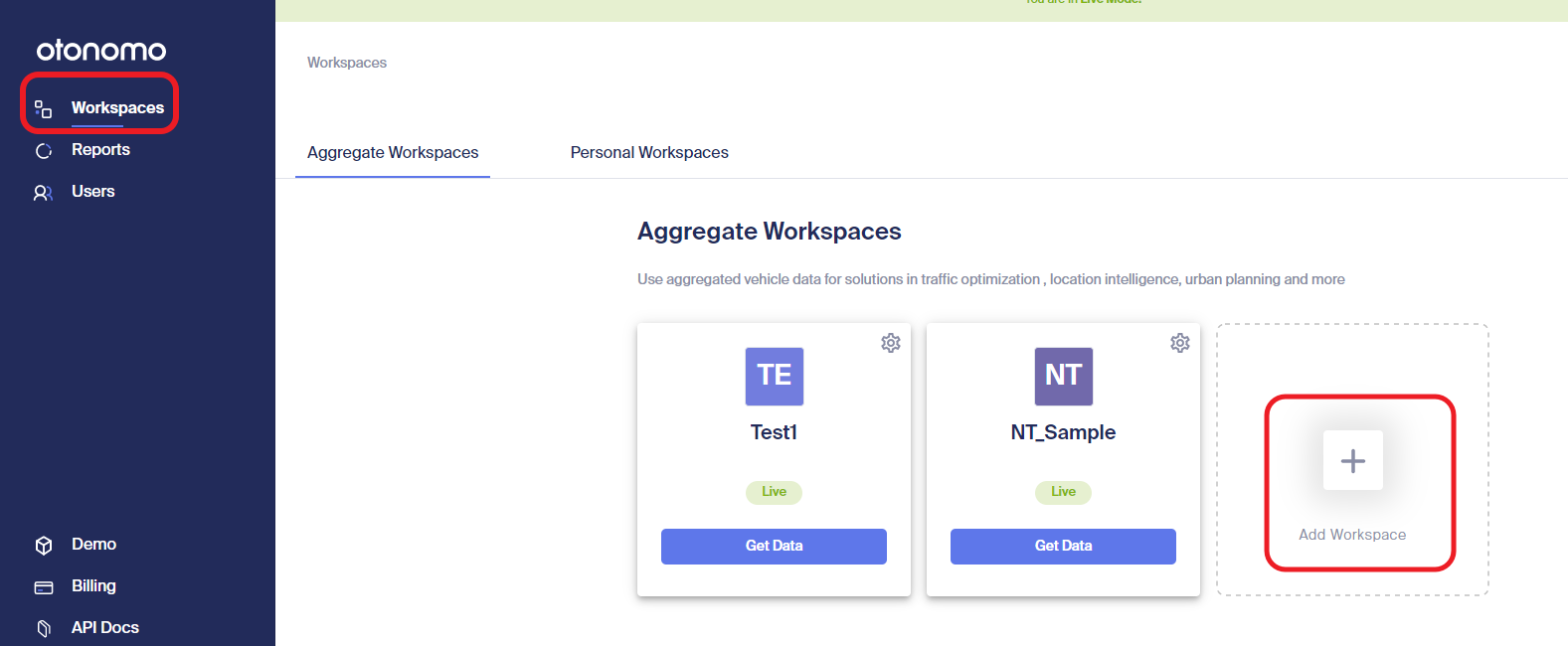
- Login to Otonomo platform at market.otonomo.io
- Press "Add Workspace" button on the top of your screen, next to the the Workspaces listing

Step #2 - General Settings Configuration
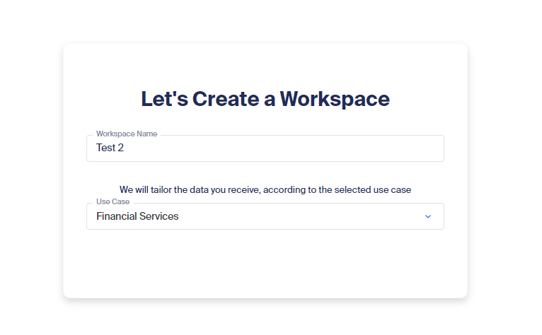
- Add Workspace name
- Select a use case from the available list
Below you will find a list of the available use cases. - Click Next

Optional Use Cases:
| Use Case | Description |
|---|---|
| Regulatory Bodies | Government, state agencies and NGOs use vehicle data to research fuel and energy consumption compliance information and obtain independent confirmation. Governments may also be interested in obtaining statistics such as seat belts usage to better target safety campaigns. |
| Gas & Energy | Allows gas and energy companies (e,g, Shell, BP, ExxonMobil and others) to better understand patterns of drivers that consume fuel and other products in fuel stations. These data sets can help define how to market to those drivers who did not stop at their locations. |
| EV Infrastructure | Obtain information on EV drivers behavioral patterns (for example 'Range Anxiety'), identify optimal locations for placements of public charging stations, and to help with issues regarding load balancing of the power grid. |
| Greenwave Service | Leverage offline and real-time traffic data to calculate patterns and vehicles routes to allow the driver to know the speed needed to catch the green light wave on his route. |
| Safety & Emergency | Improve response times, reduce congestion, decrease property damage, and save lives with connected car data. Information like airbag triggering, hard braking, speed, and location give emergency responders a headstart and also identify problem areas to transportation planners. |
| Traffic management | Empowering cities, governments, mobility providers and urban planners to predict traffic patterns, gain accurate and real time street level insights, and reduce traffic congestion and optimize road conditions. |
| Location Intelligence | Enabling retailers, real-estate asset managers, financial services and advertisers to better understand customers' spatial behavior (where do people come from, how long they spent in each location, popular times and more associated with each POI), identify best locations for business and optimize operations. |
| Parking | Find parking place: Parking applications leverage vehicle data to optimize on and off-street parking vacancies. These services help drivers locate available parking spots on the street or in parking lots and reduce city congestion. Data is also used to better estimate parking lots availability Automated parking payments: Parking apps which allow seamless payment for parking services for consumers and fleets |
| Media & Advertisment | Media data from entertainment systems is used to improve and personalize out of home advertising in public areas including roadside advertisements. |
| Navigation & Mapping | Help commercial organizations, municipalities and state agencies to build and update SD and HD maps. Vehicle data is also used to provide real time traffic data feeds and analysis. Other applications can include sensor-based analysis of right of way for utility companies surveying sites for installation of items such as transmission lines. |
| Financial Services | Financial organizations such as Hedge Funds employ various alternative data sources to obtain advantages in choosing investment opportunities. Vehicle data can be used as alternative data used to provide unique insights on, for example, customer traffic to and from shopping centers and commercial businesses and the amount of time spent there in order to evaluate the performance of those businesses. |
| Automotive Parts Improvements | Tier1 and Tier2 automotive parts vendors use vehicle data to assess their manufactured parts and components performance and improve their product development processes. |
| Media Research & Ratings | Audience measurements help advertisers and advertising agencies measure radio listening habits and generate radio ratings for commercial, media spend optimization and content production. |
| Weather | Organizations and companies performing weather research and weather prediction collect weather related information such as temperature, pressure, and precipitation to build more accurate weather maps and predictions. |
| Smart city | ities and organizations that operate smart city infrastructures require vehicle data to obtain insights such as dangerous road assessment, emergency and roadside assistance, as well as to analyze road and traffic management issues. It can also be used to identify, react and investigate car accidents faster, and real-time alerts on road hazard conditions. |
| Fleet Management | Vehicle data is used by fleet owners to perform benchmarking and comparison research on their own fleet performance compared to benchmarks. On the personal case, fleet data is used to provide driver-specific fleet services such as routing and automated parking payments. |
Step #3 - Choose Data sets and Attributes
In this step, you will choose the required Data sets and their attributes for your Workspace.
Data Sets
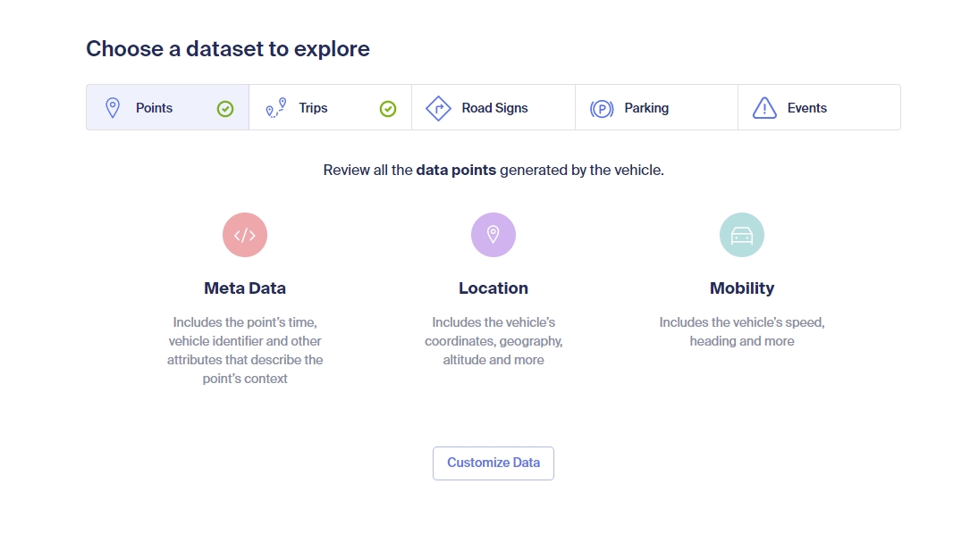
First select the Data-set you would like to explore.
Data-set defines the type of data that the Workspace will support.
There are a few types of Data sets:
- Points - Each record describes a sampling of all the vehicle's available sensor data in a specific time
- Trips - Each record describes a single trip summary
- Road Signs - Each record describes a single road sign observation
- Parking - Each record describes a parking spot or road hazard detections using the vehicle’s Ultra Sonic Sensors (USS)
- Events - Each record provides attributes that are related to a certain event, such as: heavy rain, dense fog, breakdown, traffic jam tail.

Click on "Customize Data" for the relevant Data-set and you will be redirected to the Attributes screen.

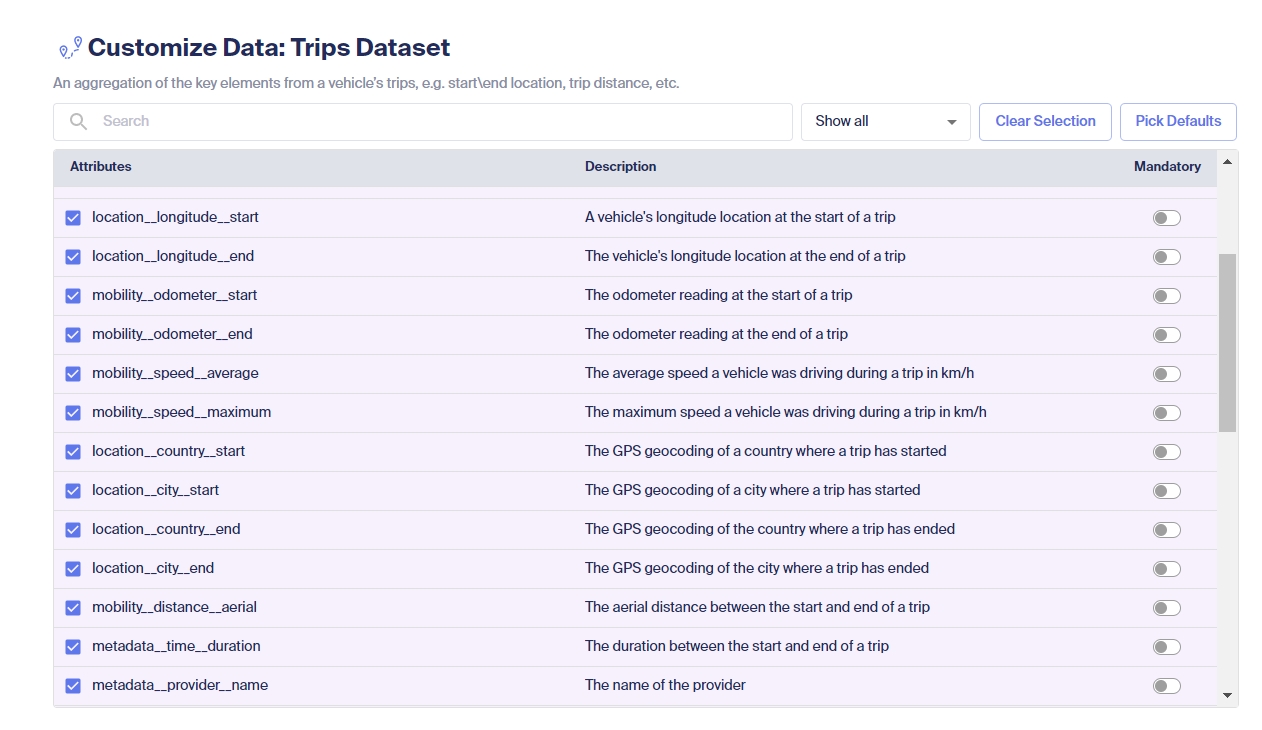
You have the option to Search for a certain attribute. Please note: the keyword is searched either on the "Attributes" column or the "Description" column.
By default, the filter column will be set to "Show All", and therefore all the available attributes will be listed. You can change it to "Show Selected" and then only the attributes you selected for this Workspace will be presented.
Pick Defaults - By choosing the default attributes, the Workspace will be assigned with the most commonly used attributes. Once chosen, you can add/remove additional attributes to this list.
You can set an attribute as a Mandatory attribute.
What are Mandatory attributes?
When you mark an attribute as Mandatory, it means that any data that will be received by the Workspace will have a valid, non-empty result for that attribute.
If for any reason, a data point from a vehicle is missing a mandatory attribute value, that point will not be included in the provided data/report.
By default, all the attributes are set to Optional. If you want to set an attribute as Mandatory, activate the toggle on the right.

Click "Finish" to create the Workspace.
Step #4 - Generating a Report
Once you finished creating your Workspace, you will be able to consume vehicle data report either through The Self-Serve Platform or the API.
To read more go to Creating reports
For any additional questions or help, please contact us at [email protected]
Updated 12 months ago
Understand how to use our APIs to retrieve vehicles data
